GEOTECHNICALENGINEERING
VANCOUVER
HomeUnderground ExcavationsGeotechnical excavation monitoring

Geotechnical Excavation Monitoring in Vancouver: Protecting Your Project from Shifting Ground

Knowledgeable. Thorough. Resourceful.

LEARN MORE

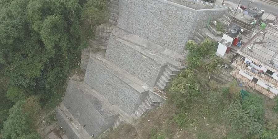
Vancouver's skyline didn't just rise from the coastal plain—it had to contend with a geological legacy that makes every excavation a careful negotiation with the ground. From the redevelopment of the old Expo lands to the glass towers punching through the False Creek basin, the city sits on a mix of glacial till, marine silts, and sandy lenses deposited during the last ice age. You can't just dig and hope. The water table sits high, often just a couple of meters below street level, and the 2015 NBCC seismic requirements mean lateral earth pressures get calculated with a healthy dose of conservatism. Our team brings the instruments right to the edge of the cut, running continuous monitoring programs that track wall deflection, tieback loads, and groundwater drawdown in real time. When the excavation passes that critical depth—usually around the fourth level of underground parking downtown—the slope stability parameters established during the design phase need field validation, and that's where automated inclinometers and load cells prove their worth.

In Vancouver's glacially consolidated soils, a wall that doesn't move at all is often over-designed—but a wall that moves too much can trigger settlement claims across the street.

Our service areas

Methodology and scope

The maritime climate throws a curveball that drier regions don't face: persistent winter rains saturate the upper fill layers, jacking up pore pressures behind shoring walls exactly when daylight hours are shortest and construction schedules tighten. We've seen November storms in Kitsilano push pore-water readings 40% above baseline in less than 48 hours. That's why our monitoring approach pairs vibrating-wire piezometers with automated theodolite networks—you get groundwater data and surface settlement marks feeding the same dashboard. For projects near SkyTrain tunnels or the Canada Line bored structures, vibration thresholds get strict fast. We cross-check the excavation-induced movements against the pre-condition surveys and the structural tolerance limits spelled out in the project's impact assessment, and we often integrate CPT testing data from the pre-construction phase to ground-truth the stratigraphy at the corners of the dig, where the model tends to diverge from reality. The interplay between the stiff Vashon till and the underlying sensitive silt layers means you can't just set a generic alarm value; each inclinometer zone gets its own trigger, calibrated to the soil behavior observed during the first meter of cut.
Geotechnical Excavation Monitoring in Vancouver: Protecting Your Project from Shifting Ground
Technical reference — Vancouver

Local considerations

Look, anyone who's worked a deep dig in the West End or along the Broadway corridor knows the real risk isn't the soil you studied in the borehole logs—it's the utility trench backfill that nobody compacted properly in 1972. We find that a lot. A beautifully instrumented shoring wall can perform within 2 mm of the predicted deflection, but the sidewalk settlement 3 meters behind the wall tells a different story because a storm drain trench collapses internally. That's why our monitoring plans always extend the settlement array beyond the zone of influence that the finite element model suggests. The second risk is time: a contractor wants to cut fast, but the pore pressure dissipation in the low-permeability glaciolacustrine silts under South Vancouver lags behind the excavation rate. Cut too fast, and you load the wall with undrained pressures that the structural engineer didn't design for. That's when you see the inclinometer curve start to dogleg at the middle of the cantilever stage. We've caught those deflections early enough to recommend a temporary berm or an extra row of anchors more times than we can count, and the cost of that intervention is a rounding error compared to a shoring failure or a neighboring building evacuation.

Need a geotechnical assessment?

Reply within 24h.

Email: contact@geotechnicalengineering.vip

Explanatory video

Applicable standards

CAN/CSA-S832-14 (R2019) — Seismic risk reduction of operational and functional components of buildings, ASTM D3966-07 — Standard test methods for deep foundations under lateral load, FHWA-IF-99-015 — Ground anchors and anchored systems, NBCC 2015 — Structural Commentaries, Part 4, Division B, ASTM D7299-12 — Standard practice for verifying performance of vertical inclinometer probes

Technical parameters

ParameterTypical value
Typical monitoring duration3 to 18 months (pre-excavation to backfill)
Inclinometer accuracy±0.25 mm/m (digitized MEMS probes)
Vibrating-wire piezometer range0–350 kPa, resolution 0.025% FS
Automated total station frequencyEvery 15–60 min, 24/7 during active cut
Load cell capacity (tieback anchors)Up to 2,000 kN, calibrated to ASTM D3966
Settlement marker precision±0.5 mm, referenced to deep benchmarks
Data reporting intervalDaily summary + real-time SMS alarms at 80% threshold
Applicable standard for monitoringCAN/CSA-S832-14 (R2019), FHWA-IF-99-015

Frequently asked questions

How much does geotechnical excavation monitoring cost for a typical Vancouver project?

For a standard mid-sized excavation—think a four-level underground parkade in a single-lot development—you're generally looking at a range of CA$1,070 to CA$3,320 per month of active monitoring, depending on the number of instruments, whether you need automated versus manual readings, and how tight the reporting frequency is. A full automated system with web dashboard and SMS alarms sits at the upper end, while manual inclinometer and survey point readings with weekly reports cost less. We quote fixed monthly rates, not per-reading charges, so you can forecast the cost through to backfill without surprises.

What instruments do you typically install for a deep excavation in Vancouver?

The baseline setup includes inclinometer casings behind the shoring wall, vibrating-wire piezometers at two depths in each borehole, load cells on a representative sample of tieback anchors, and an array of settlement points along the adjacent right-of-way. For sensitive neighbors or transit-adjacent sites, we add tiltmeters on adjacent building columns, crack gauges across existing fissures, and an automated total station network that tracks prism targets every 30 minutes. All instruments get calibrated to their respective ASTM standards before mobilization.

How do you handle monitoring near SkyTrain or Canada Line tunnels?

TransLink and the Canada Line operators have strict vibration and displacement criteria that go beyond typical municipal permits. We install triaxial geophones at the tunnel invert and track peak particle velocity in real time against the 25 mm/s threshold commonly cited for bored tunnel linings. Inclinometer casings get extended to depths below the tunnel invert elevation to capture any deep-seated movement. We also pre-condition survey the tunnel interior before excavation starts, documenting every existing crack and spall so that post-construction claims have a factual baseline.

What happens if an instrument reading hits the alarm threshold?

The protocol is staged. At 70% of the trigger value, the system sends an advisory email to the project coordinator—no action required, just awareness. At 85%, the site superintendent and the geotechnical engineer of record get an SMS, and we increase the reading frequency on the affected instrument to every 15 minutes. If it hits 100%, an emergency alert goes to the full distribution list, and the excavation work stops in the affected zone until the engineer reviews the data and either revises the trigger or orders mitigation like additional bracing or a temporary berm. We've never had a failure because we catch the trend during the advisory stage.

How long do you need to keep the instruments running after the excavation is backfilled?

We recommend a minimum of three months of post-construction monitoring at a reduced frequency—typically weekly readings—to confirm that pore pressures have equilibrated and that any consolidation settlement in the underlying compressible layers has asymptoted. For projects overlying the sensitive marine silts found in parts of Richmond and Delta, we often extend this to six months, because those soils can exhibit delayed compression. The data set gets compiled into a close-out report that the structural engineer and the owner's legal counsel can reference if neighboring damage claims surface later.

Location and service area

We serve projects across Vancouver and its metropolitan area.

View larger map