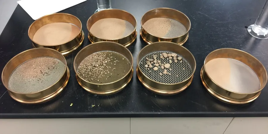
In Vancouver, we often see grain size distributions that look textbook but behave differently in the field. A clean-looking sand from the Quadra unit can carry 6–8% silt that cuts permeability by an order of magnitude — and that shows up fast once excavation hits the water table. Our lab runs the full stack: mechanical sieving plus hydrometer sedimentation per CSA + ASTM D422 and D6913, so the PSD curve doesn't miss the fines tail. The data feeds straight into USCS classification, frost-susceptibility checks, and filter compatibility for retaining structures. When the project site sits on Vashon till with cobble-sized clasts, we coordinate with the field crew to capture the oversize fraction because ignoring it skews the whole curve upward. For deeper glaciomarine silts, the Atterberg limits lab run on the same split sample gives the plasticity index needed to confirm whether those fines are actually clay or just rock flour that drains reasonably well.
A three-point hydrometer curve on Vancouver's glaciomarine silt can shift the USCS classification from SM to ML — and that single letter changes the allowable bearing pressure under NBCC 2015.