Geotechnical investigation in Vancouver is the critical first step in any construction or civil engineering project, providing essential data about subsurface conditions to ensure structural safety, stability, and compliance with local regulations. The city's unique geological setting—nestled between the Coast Mountains and the Pacific Ocean—creates complex soil profiles that demand thorough understanding before breaking ground. From downtown high-rises to infrastructure in the Fraser River delta, a comprehensive site investigation reduces the risk of unexpected ground conditions, costly delays, and potential failures. In a seismically active region like British Columbia, these assessments are not merely best practice but a fundamental requirement for protecting both property and lives.
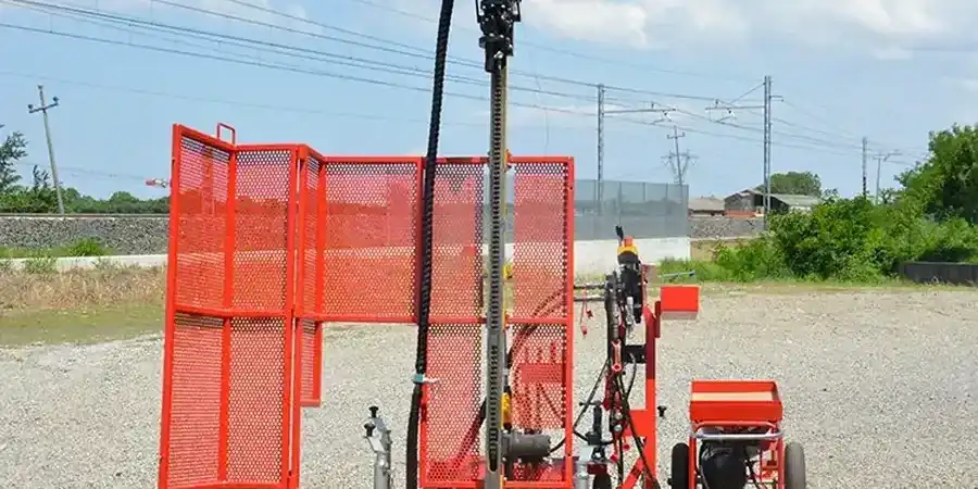
Vancouver's geology is dominated by glacial and post-glacial deposits overlying bedrock, with significant variations across the metropolitan area. Much of the city sits on thick sequences of glacial till, marine silt, and clay, while areas like Richmond and Delta feature compressible organic soils and loose sands prone to liquefaction during earthquakes. The proximity to the Cascadia Subduction Zone elevates seismic risk, making site-specific response analysis essential. Coastal bluffs and steep slopes in North and West Vancouver introduce additional hazards such as landslides and erosion. These local conditions mean that a desktop study alone is insufficient; physical exploration through methods like the Cone Penetration Test (CPT) is often required to characterize soil behavior accurately, especially for deep foundations or liquefaction assessments.
In Canada, geotechnical investigations fall under the National Building Code (NBC) and the British Columbia Building Code (BCBC), which mandate site evaluations for most structures. CSA Group standards, particularly CSA-A23.3 for concrete design and CSA-S6 for bridges, reference the need for geotechnical input. Professional practice is governed by Engineers and Geoscientists BC (EGBC), which enforces stringent guidelines for site characterization, reporting, and ethical conduct. Municipal bylaws in Vancouver, such as the Zoning and Development By-law, often require geotechnical reports for rezoning, subdivision, or development permits, especially in environmentally sensitive areas or zones with known geohazards. Adherence to these regulations is non-negotiable, and reports must be sealed by a licensed professional engineer or geoscientist.
The types of projects that require geotechnical investigation in Vancouver are diverse, ranging from single-family homes on sloping lots to large-scale commercial towers and public infrastructure. Deep excavations for parkades in the downtown core demand shoring design based on accurate soil parameters, while bridge and road projects rely on investigations to prevent settlement and ensure subgrade stability. Industrial developments, port facilities, and seawalls along the Burrard Inlet or Fraser River must account for tidal influences and soft marine sediments. Even smaller residential projects may trigger the need for a site investigation if located in areas with high water tables or mapped landslide susceptibility. In every case, integrating field data from in-situ tests and laboratory analysis into a geotechnical model is the foundation for safe, cost-effective design.
A typical investigation includes a desktop review of geological maps and historical data, followed by a field program involving boreholes, test pits, or in-situ tests like CPT to collect soil and groundwater samples. Laboratory testing determines strength, compressibility, and chemical properties. The final report provides site characterization, foundation recommendations, seismic considerations, and construction constraints, sealed by an EGBC-registered professional.
The BC Building Code and Vancouver's Zoning and Development By-law generally require a geotechnical report for any structure involving deep excavations, foundations on slopes, or sites with known hazards like liquefiable soils or landslide risk. Rezoning, subdivision, and development permit applications in sensitive areas typically mandate an investigation. Even outside formal triggers, lenders and insurers often require one for major projects.
Vancouver's location in a high-seismic zone means investigations must explicitly address earthquake hazards such as soil liquefaction, cyclic softening of clays, and slope instability. Site-specific seismic site class determination per the BCBC is mandatory. Advanced field tests like CPT and shear wave velocity measurements are commonly used to assess dynamic soil properties, informing foundation design and ground improvement needs.
Duration varies from a few weeks for a simple single-family lot to several months for a complex multi-phase project. Factors include site access, scope of fieldwork (number and depth of boreholes or CPT soundings), laboratory testing requirements, and reporting complexity. Costs are driven by equipment mobilization, crew time, specialized testing for seismic or environmental parameters, and the level of analysis needed to meet regulatory standards.
We serve projects across Vancouver and surrounding areas.